Dreaming of stepping from your Naples backyard onto your boat and cruising straight to the Gulf? If you are comparing waterfront homes, understanding how canals, depths, docks, and marinas work will help you choose with confidence. This guide explains the canal-to-bay-to-Gulf route, what affects navigability, how permitting works for docks and seawalls, and where you can find reliable services. You will also get a buyer’s checklist you can use on any property. Let’s dive in.
Naples boating route at a glance
Canal to bay to Gulf
Most Naples waterfront homes follow a simple pathway to open water: canal to Naples Bay and the Gordon River, then out Gordon Pass to the Gulf of Mexico. Gordon Pass functions as the main gateway for local boaters leaving Naples Bay. This canal-to-bay-to-Gulf sequence is the typical route for the majority of Naples properties. For context on how these waterways developed and connect, see the regional overview of Southwest Florida waterways and passes summarized in this historical geography source.
Charts, tides, and depth basics
On official nautical charts, depths are shown relative to Mean Lower Low Water (MLLW). That means the number on the chart is a conservative baseline during a typical low tide. Before relying on any single reading, check a current chart and local tide predictions, as advised by the U.S. Coast Pilot guidance for the Gulf region outlined here. When you evaluate a property, ask for a recent depth reading at the dock referenced to MLLW.
Canal access factors that matter
Canal type and position
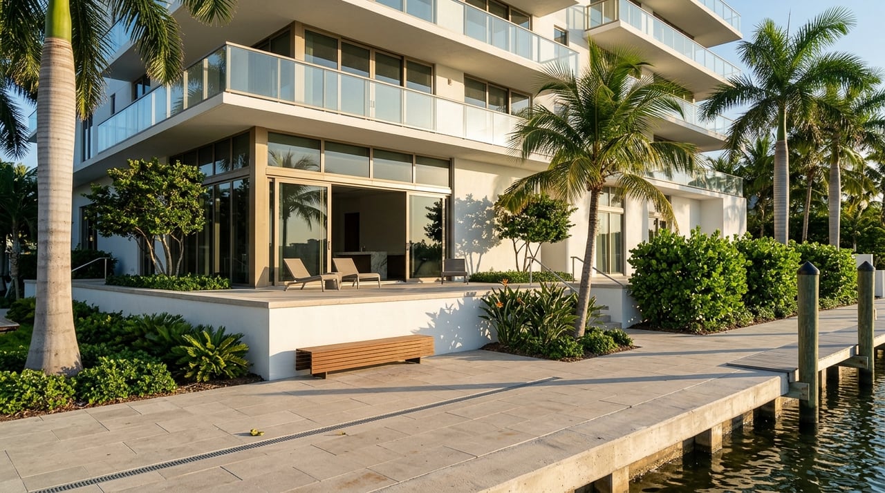
Not all canals behave the same. Through-canals that connect both ends to larger channels often flush better and can hold depth more consistently than dead-end canals. Your lot’s position also matters. Corner, mouth, or interior locations change turning space, sun and wind exposure at the dock, and real transit time to the pass.
Physical constraints to check
Several physical features determine what boats you can use from a property:
- Depth at the dock at MLLW, which must cover your boat’s draft plus a safety margin.
- Canal width and any turning basin if you run a longer or wider vessel.
- Fixed bridges or overhead lines that set an air-draft limit. Some downtown basins publish example clearances, which is critical for sailboats and tall tower boats, as shown in the bridge details posted by Docks on 5th.
- Local speed and no-wake areas that affect real-world travel time.
Gordon Pass and the open Gulf
Shoaling and dredging dynamics
Gordon Pass is a natural inlet influenced by tides and shifting sand. Shoals can move between maintenance cycles, which is why depths may change after storms or over time. The pass and federal channel segments are periodically dredged to maintain navigability, with documented contracts and authorized depths referenced in public notices. For an example of these maintenance programs and why they matter, review a U.S. Army Corps dredging contract summary discussed here. Before you rely on a specific depth, verify recent dredging status and take an on-site reading at low tide.
Outside vs inside routes
Once you exit Gordon Pass, you can run outside in open Gulf water or, for some itineraries, use more protected inside routes between passes. The choice depends on your vessel, sea state, and time. A historical overview of local waterways and boater patterns provides helpful context in this regional reference.
Docks, seawalls, and permits
Local permitting and typical submittals
Dock, seawall, lift, and marine demolition work in Collier County follows a defined submittal process. You will typically need a signed and sealed site plan, construction drawings, and owner and contractor information. The county’s Marine (PRMAR) checklist is the practical starting point for requirements and applications. Review the process on Collier County’s PRMAR page.
Some projects also require state authorization or federal review. If work extends into navigable waters or involves dredge or fill, U.S. Army Corps of Engineers general or individual permits can apply. You can see how these federal authorizations are structured in official permit summaries published here.
City of Naples geometry rules
Depending on the neighborhood, City of Naples ordinances can set setbacks from property lines, maximum waterward projection, and other geometry limits. These rules determine whether you can extend a dock into deeper water or add piles. Always confirm the current code for your parcel. A code reference tool summarizing local provisions is available on this municipal code resource.
Ownership, HOAs, and insurance
On single-family lots, owners are often responsible for dock and seawall maintenance. In many condos and planned communities, docks may be common elements with assigned slips and rules for transfers, lifts, and guest use. Review the deed, plat, and HOA covenants before you assume any rights. Also ask how docks, lifts, and boat storage are insured, since standard homeowner policies may exclude or limit these structures.
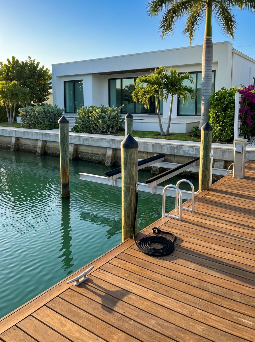
Marinas and launch options nearby
Downtown services and fuel
Naples City Dock at Crayton Cove is the city’s municipal marina. It offers transient and annual dockage, fuel, pump-out, and a walkable downtown setting. Published descriptions note approach and dock depths that typically support a range of recreational vessels, but you should confirm berth depth directly with the marina. The facility also references nearby public trailer access at Naples Landing. Explore current services on the City of Naples City Dock page.
Bayfront access in town
If you prefer a downtown setting adjacent to dining and shopping, Bayfront Marina provides immediate access to Naples Bay. Slip availability and visitor policies vary, so confirm details directly with the facility. Learn more at Bayfront Marina.
Southern gateway to the Ten Thousand Islands
For quick access to the Ten Thousand Islands and Everglades, Port of the Islands Marina south of Naples offers a full-service operation with slips and a boat ramp. It is a practical option for larger vessels or for owners who value direct access to backcountry cruising and fishing. See current offerings at Port of the Islands Marina.
Bridge clearance examples
Some inner basins and canals have fixed bridges that limit air draft. Example clearance figures published by local marinas help you plan if you own a mast or tall tower. For a downtown reference, review the posted bridge details from Docks on 5th.
Buyer due diligence checklist
Use this step-by-step list to compare properties with confidence:
Confirm dock and seawall status. Ask whether the structures are included in the sale, who maintains them, and whether permits and final inspections are on file. Start with the county’s requirements outlined on the Collier County PRMAR page.
Get a dated depth reading at MLLW. Request a recent measurement at the dock face with the date, tide reference, and method. This is more reliable than relying only on chart soundings.
Map the route to Gordon Pass. Note no-wake zones, typical traffic, and any fixed bridges. Estimate travel time based on realistic speeds for your boat and crew.
Verify vertical clearances. If you run a sailboat or a high tower, confirm a true no-bridge route or published fixed-bridge clearances for your path.
Check permitted dock geometry. Confirm shoreline setbacks, maximum projection, and whether the current permit would allow an extension to reach deeper water. Review city rules on a current code reference such as this municipal summary.
Review HOA or condo rules. Ask for slip assignment policies, waitlists, lease terms, lift types allowed, and any planned dredging or seawall projects that could affect use or fees.
Validate service access. Identify nearby fuel, pump-out, and repair options that match your boat size and power needs. For downtown services, the City Dock page is a helpful starting point.
Ask about storm planning. Clarify marina or HOA hurricane protocols, haul-out options, and any insurance requirements related to securing vessels.
Plan ahead for improvements. If you intend to rebuild a dock, add a larger lift, or change the footprint, review the Collier County PRMAR requirements and confirm whether state or federal permits will be needed.
Confirm dredging and shoaling history. Before you rely on a specific draft, check recent maintenance activity at Gordon Pass and ask for on-site depths at low tide. Public dredging contracts and notices provide useful context, such as the maintenance summary described here.
Work with a local advisor
Finding the right Naples waterfront home is about matching your boating style with real, verifiable access. A knowledgeable advisor will help you read charts and permits, request the right documents, and compare docks, depths, and marina services by neighborhood. If you are navigating this from out of state or abroad, concierge support can streamline inspections, contractors, and approvals.
If you would like tailored guidance on Naples and Marco Island waterfront options, Request a Private Consultation with Angelica Andrews.
FAQs
How do boats reach the Gulf from most Naples homes?
- Most properties follow a short route: canal to Naples Bay and the Gordon River, then out Gordon Pass to the Gulf, which is the area’s primary inlet.
What does MLLW mean for my dock depth reading?
- MLLW is the chart datum used for depths, reflecting typical lower low tide. A depth measured at MLLW gives a conservative baseline for your boat’s draft planning.
Who permits docks and seawalls in Collier County?
- Collier County manages local building permits, and some projects may also need state and U.S. Army Corps authorization if they affect navigable waters or require dredge or fill.
Is Gordon Pass consistently deep for larger boats?
- Depths can shift due to shoaling. The pass is periodically dredged, but you should confirm recent maintenance and take a current on-site depth reading before relying on a specific draft.
Where can I find fuel and transient dockage near downtown?
- Naples City Dock offers fuel, pump-out, and dockage in Crayton Cove. You can also explore nearby facilities like Bayfront Marina for additional options.